


In case you missed it see what’s in this section

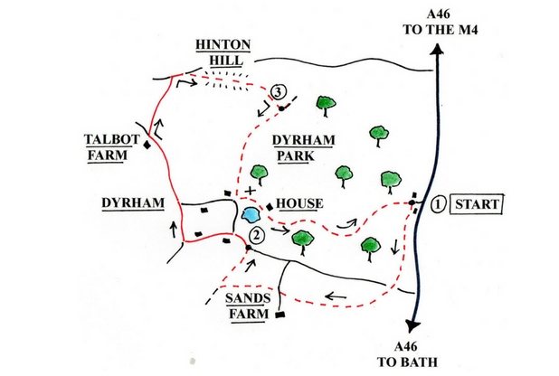
Dyrham Park
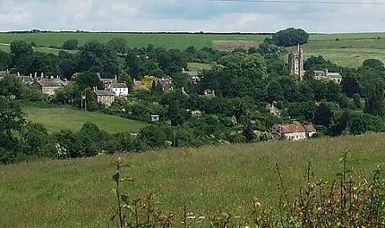
Dyrham Park offers so much more to the visitor than a grand house. There is a Dutch-inspired water garden and 270 acres of parkland, a formal garden with pools, a series of lost terraces and also a tearoom to stop off and warm up in. The walk leaves this National Trust estate to explore the nearby Cotswold escarpment. As well as extensive views along the escarpment, the views also take in the Severn Vale and Bristol, Dundry Hill and the Mendips, the Bristol Channel and South Wales.
Walk: 4 miles (6.4km) - allow 4 hours.
Terrain:
- Two climbs, one onto Hinton Hill and one back up to the car-park from Dyrham House.
Where: The walk starts at the National Trust car-park at Dyrham Park. Grid reference ST749756, view it online here.
Note: Non-members will need to buy a day ticket for at least Dyrham's park and gardens for this walk. Unfortunately no dogs allowed.
Route map:
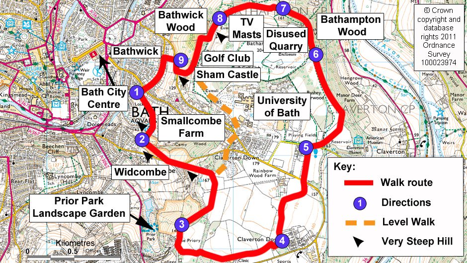
Bath Skyline
Having been labelled the most popular of the National Trust’s walks, the Bath Skyline walk had to come top of the list. Walk through history from an Iron Age hill fort to 18th-century follies and stroll through hidden valleys, woodlands and patchworks of small meadows, all rich in wildlife. This walking trail is excellent year-round, plus the National Trust assures us that this route burns off as much energy as playing 90 minutes of football – just the sort of thing to get that New Year’s health-kick started.
Walk: 6 miles (9.6km) - allow 4 hours.
Terrain:
- Paths are muddy in wet weather and steep in places, with some stiles and gates.
- Moderate difficulty
Where: Start in Bath city centre at Bathwick Hill. For directions click here.
Route map:
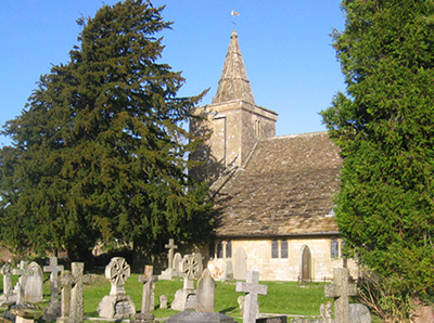
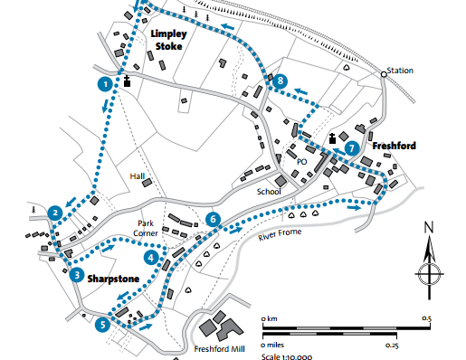
The Two Church Circular
Negotiate the ‘squeeze belly’ in this attractive little walk linking the churches at Freshford and Limpley with the added bonus of the River Frome, with welcome stops at the Inn at Freshford and the Hop Pole at Limpley Stoke to warm up and refuel.
Walk: 2 miles (3km) - allow 1 hour
Terrain:
- Easy route, a few gates
- Some muddy parts, be sure to wear wellies!
Where: Start at the Limpley Stoke Church. Grid reference ST780608 , view it online here.
Route map:
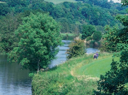
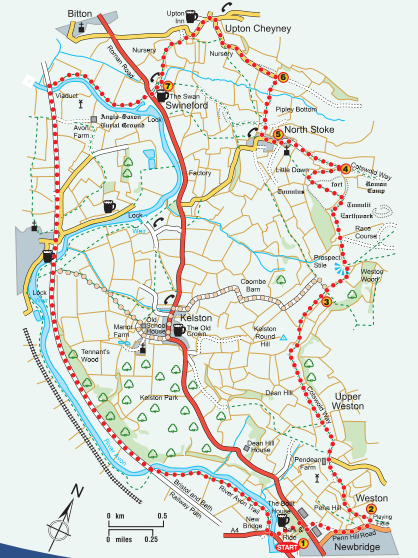
The Bath and North Stoke Trail
This walk explores the rural landscape of the Avon Valley between Bath and Bristol. You’ll find secluded woodland and meadows, and hills with panoramic views. And there’s evidence of man’s use of the valley for thousands of years, with an ancient hillfort, a Roman vineyard and a racecourse as well as canals, railways, contemporary cyclepaths and plenty of pubs. It’s a walk with something for everyone!
Walk: 10½ miles (16km) full route or 8 miles (12km) via Kelston - allow 5 hours for full route or 3 hours for shorter route.
Terrain:
- Medium/hard difficulty
- Some steep sections
Where: Start at Bath - Newbridge Park & Ride site. View it online here.
Route map:

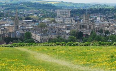
Dyrham Park
Dyrham Park is a National Trust owned park, property and estate located on the outskirts of Bath. Although the property is a delight to explore, the grounds make a stunning walk especially in the Autumn too. Before you even reach the house, you're greeted with miles of untouched rolling hills allowing with amazing views towards Bath and Bristol. You're almost up in the clouds though - so be sure to wrap up!
The formal gardens are just as much as a treat with stunning seasonal flowers and gorgeous deep reds, bright oranges' and golden brown leaves scattering the paths.
Distance: 2 - 5 miles
Estimated Time: 45 minutes - 3 hours (depending on length of walk)
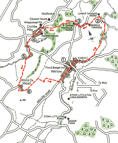
Wellow Walk
A green valley walk, where Cotswold melds into Mendip, tracing a legacy of abandoned industry and failed technology. Why not stop off at The Wheatsheaf at Combe Hay, a handsome old building with a flowery terrace. It serves real ales and good grub, perfect for a temporary escape from the winter chill!
Walk: 6.4 miles (10.4km) - allow 4 hours
Terrain:
- Medium difficulty, Ascent/gradient 984ft (300m)
-
Byways, stream sides and some field paths, 12 stiles
Where: Start at The Fox and Badger, Wellow. Grid reference ST739583, click here to view it online.
Route map: